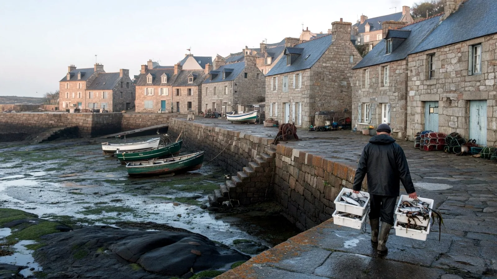
Normandy's coast is soaked in history and painted in every shade of grey, white, green, and silver. From the chalk arches of Étretat (which Monet painted obsessively) to the D-Day beaches (which changed the 20th century) to the tidal miracle of Mont-Saint-Michel (where the sea retreats to the horizon and returns at the speed of a galloping horse), this is a coastline of extraordinary drama despite its gentle appearance on a map.
| Normandy Coast | Detail |
|---|---|
| Length: ~600 km | |
| Character: Chalk cliffs (Pays de Caux), sandy beaches, tidal flats | |
| Tidal range: 8–15 m (Mont-Saint-Michel Bay — among the world's highest) | |
| Key features: Étretat cliffs, D-Day beaches, Mont-Saint-Michel | |
| Climate: Mild, wet, changeable — 1,600–1,800 hours of sunshine/year | |
| Coastal sections: Côte d'Albâtre (Alabaster Coast), Côte Fleurie, Côte de Nacre, Cotentin |

Côte d'Albâtre (Alabaster Coast)
The white chalk cliffs of the Pays de Caux — stretching 130 km from Le Tréport to Le Havre — are Normandy's most dramatic coastal feature. At Étretat, the chalk has been sculpted by the sea into three celebrated formations:
- La Porte d'Aval — a great arch with a needle rock (the Aiguille, 70 m)
- La Manneporte — a wider, grander arch
- La Porte d'Amont — on the opposite cliff
Monet, Courbet, and Boudin all painted here. The light — diffused through Channel clouds, reflected off white chalk and grey-green sea — is the light that spawned Impressionism.
Côte Fleurie (Flowery Coast)
The resort coast between Honfleur and Cabourg: Deauville (racecourses, luxury, film festival), Trouville (its more authentic twin), and Honfleur (a harbour painted by Boudin, Monet, and Satie). Sandy beaches, Norman-Victorian villas, and the scent of apple orchards drifting from the bocage behind.
The D-Day Beaches
On 6 June 1944, Allied forces landed on five Normandy beaches — codenamed Utah, Omaha, Gold, Juno, and Sword. Today, the 80 km stretch of coast from Sainte-Mère-Église to Ouistreham is the world's most significant modern battlefield memorial landscape:
- Omaha Beach: The bloodiest landing — the American cemetery at Colleville-sur-Mer (9,387 graves) overlooks the beach
- Pointe du Hoc: Rangers scaled 30 m cliffs under fire — the cratered clifftop is preserved
- Utah Beach: The westernmost beach — a museum marks the American landing
- Arromanches: Remains of the Mulberry harbour — an artificial port towed across the Channel
Mont-Saint-Michel Bay
The bay's tidal range — up to 15 m during spring tides — is among the highest in the world. At low tide, the sea retreats kilometres from the mount, exposing vast sand and mud flats. At high tide, the abbey appears to float on the water. The speed of the incoming tide is legendary (and exaggerated — it doesn't actually match a galloping horse, but it is fast and dangerous on the flat sands).
Walking across the bay to the mount with a certified guide is one of Normandy's most memorable experiences — barefoot through quicksand, tidal channels, and open sand, with the abbey growing larger ahead.
The Cotentin Peninsula
Western Normandy's peninsula juts into the Channel — wild, wind-swept, and dotted with rocky headlands. The Nez de Jobourg (cliffs, 128 m) and the Cap de la Hague are the peninsula's highlights — empty, powerful, Atlantic-facing. The interior is dairy country — the source of Camembert, Livarot, and Pont-l'Évêque cheeses.
Normandy D-Day Trail — Drive the D-Day coast — landing beaches, museums, and memorial sites — on La Porte.
On the ground
| Pin | Working note |
|---|---|
| Page | The Normandy Coast |
| Desk | La Terre |
| First use | Read the pins, then one related page — not five |
| Confirm | Official site or ticket desk the week you go |
If another France InfoBuffoon guide owns the beat — a park gate, a museum Tuesday, a wine list — we send you there instead of duplicating a thinner copy here. The Normandy Coast sits in a country that is easy to over-plan and easy to under-prepare. The coastlines layer is where visitors collect names. This page is the opposite: what to do first, what to skip, and which sibling guide holds the rest.
France rewards a slow unit. One arrondissement, one valley, one appellation, one park trail. The photograph of five landmarks in five days is a real holiday, and it is also a queue with a passport. If you only have three nights, spend two of them in the same bed. The third night is for a train, not a third hotel.
Working a visit
Practical France is sockets (Type E/F, 230 V), tap water that is safe, pharmacies that are the real clinic for minor trouble, and a lunch hour that still closes a village. Cards work in cities. Cash still opens some park kiosks, some island boats, and some market stalls that have never seen contactless. A lightweight adapter belongs in the personal item, not the hold.
We will not write as if every reader is on a gap year, or as if every reader is in a palace hotel. We will not flatten 'the south' into one climate. We will not treat a strike day, a jour férié, or a Tuesday museum closure as a personality quirk of the French. They are calendars. Check them. Then use The Normandy Coast as a pin, not as scripture.
Cross the five guides instead of cloning them. La Porte holds trains and the first week. La Terre holds weather and park gates. L'Esprit holds museum Tuesdays and the Revolution. La Table holds the market morning and the wine list. Le Moteur holds the Tour, the working week, and why August is empty in Paris and full on the coast.